Lugs, Chains, and Paddle Blades

With these three modes we explore the natural world around us. The lugs of our shoes, the chains of our bikes, and the blades of our paddlecraft.

This is our archive of amateur exploration.

Enjoy!

Monday, December 23, 2013

Shavers Fork

We had just landed and then unloaded our boats. We were wet but it was threatening to get dark and chilly soon, and so all of us sprung into action to make our campsite. Except for one, that is.

Immediately we all reluctantly began to notice it. Our eldest companion, clothed in nothing but a grim smile, drip-dried in the center of the group as we milled around fetching cookware, preparing our dinner, hanging up wet gear, and securing the wobbly picnic table -- general campsite maintenance upon our arrival. It reminded me of the famous gorilla in the middle of the basketball practice video. Everybody tried to pretend he wasn't there by looking elsewhere as we worked. I know he had a towel, but maybe he was saving it for something else?

It was an awkwardly long time before he was satisfied with his level of dryness and put on some clothes. By then dinner was stewing, tents had been set up and several of us had embarked on the challenging task of throwing a rope over a tree limb so our food could be hung later, out of the reach of critters.

It was Sam's birthday again! We were on the Shavers Fork of the Cheat River in West Virginia in at a lower-than-one-ought-to-be-paddling-it-in-May level, commonly known to my whitewater brethren as ELF boating (extra-low flow). The frequency of dragging heavier craft (like our trusty EKC Grumman) touched on absurd, but I'm pretty sure we all look back on that trip in 2012 as a very good one.

Birthday Boy Poses
As we typically do in the month leading up to Sam's birthday trip, online river gauges and guidebooks were bookmarked and dogeared respectively as the search for the perfect river to host our weekend ensued. Shavers Fork came up to a prime level one week out, and then dropped to the minimum recommended level. We had already fallen in love with the idea and so two days later we launched, hoping that the recommenders were river snobs.

They were not snobs. It was too low. But it was worth it.

Caught in the act of improper technique . . . no sweat; Stern man has it covered.
The night before launching, we camped at Stuart Recreational Area, near Elkins, WV, and then pushed into the crystal clear stream from the site. Wade, in his solo canoe, said it looked like good fishing. Wade comes from a family of terrible fisherman, according to at least two of his siblings. Naturally, he'd neglected to bring his pole and tackle.

Dragging in the shallows.
Jeremy and Zack, former camp counselors, elected to captain and co-captain the EKC Grumman, our sturdiest vessel, which had recently been retired from duty at the camp where the boaters had each worked summers for over a decade. The boat itself had a much longer tenure, floating kids of all ages on Cheat Lake near Morgantown for much longer.

Wade gets it done and stays dry
Alex came all the way from FLA for the trip, and he joined Sam as cousins afloat in the Old Town Guide canoe. Pop and I were back in kayaks for the trip -- he in his sea kayak and I in a slicey riverrunner called a Redline. The double-bladed kayakers loaded some gear into the canoes, ensuring that dragging them would be longer and more arduous. Not my problem!

SUP: Florida style
The Shavers Fork delivered stunning scenery and little flatwater -- exactly what we were looking for. Within the first mile we came upon a nice technical drop (class 2-) that required a line from the left shore through a couple holes. I have some memories of other drops, though they all run together at this point. In total only three other drops stand out as substantial, one with a 4-foot wide channel around a dead tree in a big hole, wiggling from the force of the current, and another at least 1/4 mile long with craggy rock cliffs extending from the right bank to the sky. The third, a broken out dam, had benign flatwater above and below (a sign of trouble in many cases) but turned out to be a cinch.


One of the many riffles

Belongs on a wall, framed, in the EKC office IMO
Once again we paddled much further the first day than we thought we would. What else are you going to do in a boat on a beautiful river in the sun with nowhere to be and lots of daylight? It ended up being about 12 - 16 miles through beautiful country. A seldom used dirt road followed up for a bit and most of the 20 or so permanent camps and cottages were for the most part tasteful. Other than that it was just what the doctor ordered -- peaceful, pristine, lush. I think Jeremy and Zack didn't even mind dragging the Grumman through the rock shoals because it meant they were looking around more.

We pulled aside at one point and ate lunch and soaked our Keen-clad feet in the water while Jeremy demonstrated all of his fabulous camping gear for us.

The long day was worth it because we scored a campsite with a picnic table. I have no idea where it is on a map, who put it there or owns it, or if it was legal to camp there. With no buildings in sight, we agreed that forgiveness after the fact is always to be prioritized over permission before.

After everybody had dressed into dry clothes, we cooked. That night, on the bank on the Shavers Fork, we filled a pot with deliciousness that none of us had anticipated. I'm not sure why our Shavers Stew turned out so perfect (perhaps it was the context) but it was the best one-pot group meal I've ever had at a campsite. We gorged ourselves.

A heavenly bend in the Shavers Fork
The next morning, it was much colder as we prepared to disembark. Pop tried out Wade's canoe and swam before he even got the thing out into the current. He banished himself from open solo boats for life and got back into his comfy 13-footer, soaking wet. He looked chilly.

It wasn't cold, but this guy is from FLA
Our second day went by in a flash, and before we even had a chance to stop for lunch we had reached Parsons, the town just upstream of our take out. When we arrived at the campground just downstream, where our car was waiting for us, we found a group of Bolivian dancers enjoying the day and swimming in the river. They were from DC and had performed at a county fair in the area the day before. As teenaged performers flirted with each other, we offered our boats for them to enjoy while our put-in vehicle was retrieved. They swamped every one of them and we all laughed as they swam them back to us.

"Setting up" camp
We couldn't leave Parson without ordering a ramp burger, and then we high-tailed it out of there to get Alex to the airport, four hours away in Pittsburgh.

Git r dun.


Tuesday, April 9, 2013

SavageYough


“Why don’t you go and run the Savage on Sunday?” Molly asked me a few weeks before a scheduled release on hands-down the greatest whitewater river within 4 hours of our home.

“How did you know there was a release on the Savage?” I asked, genuinely wondering.

“Uh, you put it on the calendar,” she responded, raising the end like a question.

And so I had. The aptly-named Savage River of Western Maryland’s Garrett County, was described by the late whitewater expert William Nealy as a “rocket ride.” And it is. And, I absolutely love to paddle it, and paddle it, and paddle it, over and over and over.

“Uh, okay. Yeah, that might be cool.”  I pretended to be mildly interested, hoping to trap her into persuading me into spending a weekend on the water. Meanwhile, a smorgasbord of mental river maps, gear inventories, boat choices, and possible additional adventures filled my head.

She fell for it. I hit the road on a Saturday evening just after smooching the kids in their beds, a wild scheme of adventure planned for the next 48 hours.

I had set several goals for my weekend and the first was to paddle the Savage River at least five times and then as much mileage on the Potomac’s North Branch as is possible in a day. And to bike the shuttle at the end of it all. Okay, so maybe that’s three goals, but whatever. I was going B-I-double-G and brought my fastest boat and packed small meals that I could eat on the fly.

On Sunday morning, the river was turned on at 8:30 am but I’d been up for over two hours. I had dropped my bike off in the middle of nowhere in Maryland, at a random access point on the bank of the North Branch. Judging by the map I was looking at, I just might be able to get to the bike and then ride it back to my car before dark. Uh, maybe. The way I was figuring, I had nowhere to be for 48 hours so who cares if I put myself in a pickle in the middle of nowhere in July. It’s not like I was going to freeze to death.

To wait for the release, I carried my boat upstream on the Savage as far as I could (much further than a car could go, and more than most others were willing to walk) just so I could put on first and paddle the ½ mile of water above the official put-in, before all the other boaters got on. I’d be the prince of the Savage, riding the blast of water out of the dam just as it began to fill the riverbed. And I was.

Then I came upon a strainer, and I wasn’t.

That’s what kayakers call dead trees down in a river. This one stretched all the way across the Savage, right in the middle of a rapid. It’s easy to see why it would be a hazard, and once I saw it I was out of my boat and on shore lickety-split. Several others caught up to me and we came up with a plan. Somehow my shift was to be the guy sitting on top of a 20-foot high boulder (Memorial Rock, if you know the Savage) warning boaters to head to shore. For an hour. I imagined my bike, 20+ miles downstream, awaiting my arrival.
How crowded the Savage getsfor the July release.
Eventually the water was shut off, but not before I carried my boat to the downstream side and high-tailed it to the take out.

Time lost: 1.5 hours.

Goal one was going down in flames.

Back at the put-in area, hundreds of boaters now waited while a crew worked on the strainer in the de-watered river. After an hour or so, I was Prince Savage again, skirting the put-in crowds by again walking upstream.  

I paddled the Savage three times, a fantastic failure of a day (I know 5 can be done; anybody want to try this summer?). On my third run, I began to look forward to the next part of my goal: to paddle the “bubble” of water released from the dam on the Savage for an unreasonably long distance as it dissipated into the North Branch of the Potomac River, bound for Cumberland, MD. I had no idea how far, but would know I was done when I reached my bike.

I paddled right past the take-out where several dozen kayakers beemed from their final run of the day. Oh yeah, look at me go! Into the North Branch I went, feeling proud of myself. I wasn’t exactly going where no man had gone before but for some reason it felt daring.

Then the water flattened out and I found myself paddling across a lake.

Now that’s a bummer. I didn’t see or hear about any dam in my last-minute research. How did I miss a lake on the map? I paddled the slackwater as it widened, and after a bit I could see a horizon where the water vanished. I skirted up to the lip of the dam and then turned upstream so I could look over my shoulder at what was below without slipping over. It must have looked like suicide to the man on shore watching me, because he about lept out of his overalls and hardhat trying to flag me down. Peering down a 30 foot high abrasive rock and concrete spillway, I deduced that it would indeed have been suicide. I paddled to shore and got yelled at.

The paper mill in Luke, MD uses the North Branch for cooling. Hence the dam. Skunked again. What a dumbass.

Minutes later I stood on the shoulder of Rt. 135 in Luke, dripping wet from 8 hours of paddling. I was nowhere near my car, and even further from my bike. I stunk like the river. My boat and I had leaves and grass all over from crawling through the weeds along the riverbank. Things weren’t looking good. I put my thumb up and was picked up by a truck with kayaks stacked in the back. I got a lift a half mile to the next access point below the dam.

The North Branch was very nice, and very long. My back began to ache and my stomach rumbled.

By 6:30 pm I was still paddling, and beginning to worry. I needed time to bike back to my car, over 25 miles away, and I hadn’t even reached my bike yet. Or maybe, I worried, I had paddled right past it without noticing. It takes a serious knucklehead to get lost on a river. There’s only one direction to go: downstream. But I was tired! Did I miss it? Was I looking in the wrong direction when I passed it? There I was, thinking I might have to hitchhike again because I hadn’t been watching the shoreline.

At 7 pm I reached the bike with a sigh of relief, changed from boat gear to bike gear, and rode back to the car. Retrieving my bike later, I’d put over 100 miles on my car in order to paddle and bike a bit more than half that. It felt like a silly accomplishment, but an accomplishment nonetheless.

That was day one. But, I’m a father of two toddlers and when I am off on my own in the mountains, I go WHOLE HOG, baby!

I headed north, crossing the sub-contintental divide into the Yough watershed and set up my tent. I was asleep within minutes.

On Monday morning I hid my boat in the weeds near the Yough, and headed to the whitewater town of Friendsville, MD. I was about to embark on my next objective, one that had been brewing for far longer than any from the previous day: to run the Upper Yough. I mean run it, on foot, in the woods, along the river, ten miles upstream.

And there I went.

There is a path along the river to a former town called Kendall, which is now a few broken stone foundations way, way back in the woods. Within the first mile I instinctively hopped over a copperhead, then looked back to confirm that I’d just hopped over a copperhead. That's when I probably should have thought hard about what I was doing alone, in the middle of nowhere. But, I didn't think about it and as the trail narrowed, still a rail grade, it was clear that not many people use this trail. After 4 or 5 miles I reached a dead end. And, the topography is sufficiently steep and strewn with monster boulders that there’s only one place to go.

I needed to cross the river. That is ridiculous – this is the Upper Yough, not a swimming hole! No man in his right mind is going to swim across the Upper Yough in running shoes and no life vest.

Ah -- an added bonus to schedule releases is knowing when there is no water in the river. So I waded right across the Upper Yough in the boogie water between Triple Drop and National Falls, like it was no sweat. Really it was no sweat; I was up to my waist, no higher.

With my lower half soaking wet I continued to run upstream, this time on rougher trails presumably packed down by boaters scouting or chasing boats. The trail was a dashed line of bushwhacking and scouting trails. Each time I lost the trail, the river was my anchor; head upstream.

Deep in the woods I happened upon an old man named Glen who was chaperoning his grandson, fishing for trout. We talked for a time about the mountains, the river, and the way things used to be. It reminded me to buy my own copy of Youghiogheny: Appalachain River, by Tim Palmer, so I could read it again. (I did, and did, and so should you).

When the trail ended for good, I was still about two miles from the official put-in and my boat. Alternating between walking in shallow sections of the river and bushwhacking, I trudged on, crossing the river a few times to look for better paths. By the end of it all, I probably ran about 80% of the Upper Yough. The rest was walking, crawling, bushwhacking, and wading. I reached my boat feeling satisfied. And tired. And hungry. Now I just had to paddle the ten miles back to Friendsville. But, the water hadn’t arrived.

With a lot of time on my hands and no place to go, I took one of the best naps ever in the grass next to my boat.

As the water began to rise, throngs of boaters arrived. I woke up, ate some more, and joined the first group of kayakers that I was familiar with. At National Falls, I summoned some of the bravado I had before becoming a father and boofed the right side, just for some icing on the cake. I nailed the line and whooped in the eddy like it was the first time. Morale was high.

After the big rapids calmed into riffles, I relaxed the outfitting of my kayak, unstrapped my helmet, and laid back on the deck of the boat. The sun was beating down on me. I looked skyward and reflected on the past two days, just as a bald eagle swooped overhead. My kids and I like to go to the family cottage and hike to spot in the woods where we can peer across French Creek at an enormous bald eagle’s nest. There are often two adult birds there, and every time we go we hope to see chicks.

I was ready to go home. I declined a beer at the take-out, strapped my boat to my roof, and hit the road.

Git r Dun.

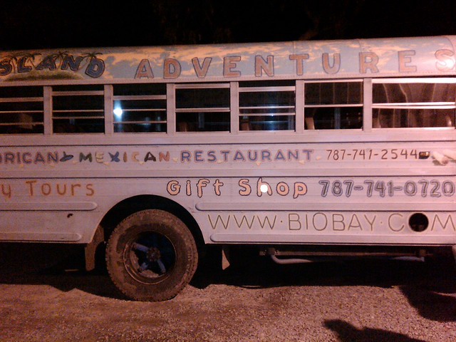
(Note: I'll get back to my Gringo tale of adventure in Puerto Rico, as well as several others that have been accumulating in my head, very soon. Summer's almost here!)

Thursday, March 28, 2013

Gringo3


Part III
Setting off from Esperanza

The third and final day of competition was based on the island of Vieques, 8 miles due east of one of the main island's bigger port cities, Fajardo. A private ferry whisked us to our destination while flying fish ripped across wave caps. Once on the small island we made our way to the town of Esperanza, the smaller, quainter of the island’s two towns where we were picked up by a small dive boat. Buzzing past rocky coral cliffs topped with lush hurricane-proof vegetation, our captain pointed out some of the more remote and hard-to-reach white sand beaches. We didn’t see a single person or inland structure for miles and when the anchor dropped to the seafloor beneath us, the sun began to bake us to crispy perfection. It was then that we were given the instructions for our next challenge: snorkeling.

In my mind, I always saw snorkeling kind of like I see golf. The activity moves – as it should – at a snail’s pace, and to get the best of it, one needs an expansive travel budget. I had heard of speed golf and saw that as a way of springing things up a bit, and that’s just what they did for us in the clear water off Vieques. Our leader gave each of us a printed copy of a satellite image. Superimposed over the image was an x marked by “you are here,” and a shaded circle of about a half mile
Climbing the Coral
away. “There is a plastic box on the seafloor in this circle somewhere,” we were told, after explaining that each of our names was written on a note inside a small waterproof box that had been anchored in the 20-foot water. Each of us had to find our own box, detach it from the rope anchoring it to the bottom of the sea, and return it to the dive boat. We donned our masks and flippers, dropped into the ocean, and waited for our starting command.

I was annoyed by the fact that this competition would be influenced in part by luck. I knew there were three cases attached to the seafloor, but was aware that the one who coincidentally happened upon the one with his own name in it would likely be the one to win the event. The only way to push to odds would be to arrive at the location of the boxes first. Oh, and I have a really lousy stroke and truly hate swimming.

Inverted Aerial - Navio Beach
Swimming at the quickest pace I could muster while wearing a snorkel was a challenge but it was diminished a bit by the scenery – most of the colorful fish scattered from me but the rays just ignored me as I swam past. A half mile is a long way to go in open seas in my book and I had to stop to check my heading frequently.  Reaching the boxes within a minute of each other, the three of us swam a 3-dimensionally chaotic course between points on the surface and the sandy bottom, gasping for air after each ear-popping descent. By the time we found our boxes and returned them to the dive boat our lungs were ripe.
The Navio Run

Our second event of that long day came after discovering the current winner of my personal lifelong quest to find the best fish tacos in the world (though based on the number of diners at Duffy’s in Esperanza, they don’t need a plug). While we digested, it was explained to us. Following a ¼ mile sprint across remote and beautiful Navio Beach, we’d rock-scramble our way up one of the sharp coral bluffs bordering  the soft sand, out to a 10 foot overhanging bit for a flying leap into the aquamarine waters. Then, a swim to three moored kayaks awaiting us would wrap up the stage, and the third stage, a kayak race, would come next.


Eight months later, I was back in Esperanza, eating those fish tacos once again. I’d won the return trip for two, but instead there were three of us.

To be continued . . .

In the next part: gringo tourists are welcomed with open arms when carrying red-headed white babies

Photos: Moncho Dapena & Ryan Bair


Production Assistants messing around in Esperanza


Tuesday, March 26, 2013

Gringo2


Part II

Day two brought us to the island’s interior. The elevations in the mountainous regions of Puerto Rico rise above 4000 feet, creating a system of rivers and creeks as steep and voluminous as many of those back home. But, it's a jungle. 

Near the village of Utuado our convoy of production assistants and technicians parked the vehicles and began a trek into the jungle. Locals had been hired to carry cameras, sound gear and (fortunately) lunch into the jungle.

A few miles later we were deep in the canyon of the shallow, rocky Tanama River. After the people in charge spent half a day telling the others what to do while we sat around, we were given our gear bags for the day. Each one contained a life jacket, helmet, and a headlamp. We were ready for our first event of the day: run the river (on foot, that is). They called it canyoneering. Splashing through the sometimes deep, sometimes shallow water, dashing across rocky beaches, and leaping off boulders into the calm pools is what they meant by river navigation. I am used to selecting lines downriver through whitewater in a kayak; I was now faced with a different kind of line selection: whether to take a dry line across a rocky bank or run through the river. Dry lines presented serious ankle-twisting risks and progress on foot could be hindered by giant boulders, but I didn’t know how deep the river was in most places.

The three of us ran at full-tilt through a canyon several hundred feet deep. The canyon’s walls were lined with swinging, vine-like roots reaching from the canyon rim to drink the waters of the Tanama. Each bend in the river presented a new decision to make and a new natural system to take in.

Swimming? Wading? Racing!
Truthfully, the competition became secondary to me as I ran the most stimulating and fun mile of my life. I was Indiana Jones running from a mob of angry natives; Tarzan sprinting through the jungle to rescue Jane and after what seemed like an instant, I rounded a corner to find a man standing in the riverbed with two arms outstretched: our finish line. 

At that moment I became suddenly aware that Zak was immediately to my right, running across a gravel bar as I swam/waded through thigh-deep water, scraping my fingers across rocks with each half-assed stroke. Through pure luck I found a shallow spot, rose to my feet, and began my sprint. We both dove for a photo finish, crashing and splashing into the inches-deep Tanama. I sat in the water and let it cool me while I gazed back at the remoteness of where I was.
The Cave

For the second leg of the day’s competition the entire crew moseyed downstream. I took the opportunity to float on my back in the Tanama, slowly moving downstream and looking up at the sliver of sky at the top of the canyon. Before long I was behind everybody and holding up the entire production.

One last bend in the river revealed a 100-foot high cave through which the Tanama runs unobstructed. The cave exit was not visible at first giving it an eerily mysterious, terminal effect from upstream. And, once inside the cave, a hard look at the high ceiling provoked a confusing pattern of lights and darks that ended with the realization that there is a vertical exit from another cave above us that leads to a dry entrance halfway out of the canyon. This place is a crazy and complicated system of caves, rocks, tunnels, and water.

A canyoneering obstacle course was described to us, which was intense and unnecessarily dangerous (I was becoming skeptical of our hosts). Our leader pointed to one of the small waterfalls shooting off the canyon wall. Swinging from the apex of the 50-foot falls was a chain ladder.

After climbing the ladder, we’d bushwhack to a trail and then run to the top of a different cave entrance (this one about 40 feet). We were to rappel down to the foot of that cave's entrance, and then embark on a a headlamp-assisted sprint through the cave to the brink of a 125-foot drop to the river below. That last drop was enough to make me glad that I hadn’t eaten much.

The Rappel from the top cave.
Without question, this competition was fool-hearty and completely unsafe. For starters, rappelling (twice!) in a race is risky because you don’t want to rush your initial attachment to a rope. But, to race through a cave, fully aware that at some point the floor would drop to nothing but thin air for over 100 feet? What if I tripped? Was this a race to the death?

Zack, Mike, and I made a pact to not compromise safety. I'm pretty sure none of us stuck to it, though.

It took me about 8 minutes. The memory of it is a tactile mesh of thick vegetation against my legs and torso, the grit of sandy dirt in my hands, the thunder of a waterfall beating down on me, and the enormous gulp I took before launching myself into the highest free-rappel I’ve ever considered. And, I’m afraid of heights.


To be continued . . . 

Next Part: a snorkel competition, beach sprint, and (almost) marathon kayak race. Stay tuned!

Photos by Ryan Bair

Git r dun!

Tuesday, March 12, 2013

Gringo

GringoBus
Being a self-proclaimed amateur adventurer, I generally avoid being corralled into a converted school bus,when I could just as well be participating on my own accord. Maybe it’s snobbery, but I guess I just like to explore the natural world on my own, guideless. So, when I found myself in Esperanza, Puerto Rico, a passenger on that school bus gleefully coated with the words Island Adventures, Bio-Bay Tours, Snorkeling, Kayaks, Puertorican and Mexican food hand painted in bright bubble letters over a pastel backdrop while I was holding a small life jacket and towel, I had a small panic attack. This is so not me. Surely the locals were saying to each other, “there goes another bus full of gringos!”

It had started a year earlier when my friend, Mike, told me about a contest being held by Mens Journal magazine, suggesting we both enter. “I’m not a beach guy,” I told him, “and I don’t really feel like putting together a video of myself; that’s too much work.” Mike proceeded without me and when it was ready, he showed me a well done but simple sequence of still photos that ended with him riding his bike into the camera and asking, “which way to Puerto Rico?” To provide contrast, he asked this question to the camera on his urban neighborhood street in Washington, DC with cops speeding past in the background, lights flashing. It was paradoxical, interesting and funny and the entire video looked simple to produce.

Before long I had produced my own video, just like Mike’s, of me climbing and paddling whitewater. I laced together a slideshow of my favorite moments captured on film and ended it, just as Mike had, with the question, “which way to Puerto Rico?” I'm posting it here, despite its embarrassingness.

It worked. Mike and I were both picked as contestants for the Explore Puerto Rico Challenge. We’d be going to Puerto Rico along with a third entry to compete in a host of events “such as mountain biking, caving, ropes, snorkeling and swimming, surfing, and paddle boarding, as well as other activities.” I'm fairly certain that not many others entered the contest, because another friend was coincidentally there shooting photographs.

Paddle boarding? Snorkeling? I live in Pennsylvania and I play in the mountains. I had sworn off caving years ago after being jammed into a cave that tapered down to about14 inches of vertical space. I remembered that and freaked out. I considered a polite thanks-but-no-thanks but my travel-savvy wife would have no part of it. It was about time, she encouraged me, that I have an adventure outside the Appalachian Mountains. The prize, an all-expenses paid return trip for two, may have had something to do with her pressure.
 
Trash-talking began, well promoted by the writing staff for MJ. I was asked for a few comments and somehow I replied with this signature line: “in the pure sense of adventure, the one to finish first is often the one leading the others.” This was published in the magazine even before the competition and I was relentlessly prodded.

“Isn’t that like saying, ‘the team with the most points wins,’” my brother Marc asked me.

“Sure, but I didn’t want to come off sounding arrogant.”

"I think you came off sounding like a knucklehead."
 
Zak
The third competitor, Zak, had said “I’m in the best shape of my life and I’m ready to dominate the competition.” After reading this, I was happy with my knucklehead remark. But, Zak was not lying and judging by his photo he could finger-flick my head off. And, he was well-versed in something I’d never heard of: Cross-Fit. I Googled it. “This guy’s going to crush me.”


After a late night flight and 5 am wake up in San Juan, the groggy team saddled up. Each day of the competition began with a gas station breakfast. Then, the next 6 – 10 hours were spent driving to a location and then waiting around for cameras and other equipment to be positioned. There were production assistants, photographers, and cameramen. There was a sound guy. And, there was even a host, a nice guy named Zay Harding (Google him; he's been around). Then, there were three people to tell all of those people what to do. 

Mike, Zak, and I became comrades in those hours of waiting.

Waiting


At a pre-competition meeting we were given schedule of events. Day one would be a mountain bike race. Day two’s stages would include “river navigation,” climbing, rappelling, and caving. The third day’s races would include snorkeling, running, and sea kayaking. Paddle-boarding did not make the list, but somebody said the ‘c’ word, and I was already shaking.

“There’s no way I’m getting in a goddamn cave,” I told Mike.

We were also given a point system and I deduced that could completely tank the caving event altogether and as long as I mostly swept the others I could win the free return trip. This last bit, sweeping, didn’t seem all that likely when I looked at Zak.

And we were off.

On Puerto Rico’s west coast lies the center of the island’s surf scene, the small town of Rincon. At a popular break called the Domes, the beach is shaded by a thick forest riddled with mountain bike trails. Those trails were closed all day long for our three-dude event. The three of us were each given a junker of a mountain bike and told to let ‘er rip.

“I’m worried I’ll break this bike,” I told one of the production assistants.

“Go ahead,” he replied, and pointed to a nearby truck holding about twenty more brand-new junkers. "We've got it covered." I pulled out a bike tool and began to adjust the bike to my liking.


Entering the forest at the Domes

The race against Mike and Zak took several hours, far less time than we spent waiting around for the race to begin. It was worth the wait. I’ve been mountain biking since around the time mountain bikes were new. I’ve sought out singletrack gold in the mountains all over the Central Appalachians and now live adjacent to (arguably) the best single track in the area. But, coming out of thick woods after blazing through rooted and rocky descents and steep, healthy climbs to see a crystal clear 8-foot pipeline crashing over coral and sand was otherworldly. 

The sea winds cooled me off on my way to another loop through the Domes trails and to another lap in the mountain bike race. At the end of the race, we thanked the local bike shop support and our electronic caravan of lights, cameras, and microphones headed to the nearest dive for local gastro-cultural bliss.

To be continued. . . . 

Next Part: Enjoying the island's mountainous interior and dropping 125 feet out of a hole in a rock.

Photos by Ryan Bair 
(except the first one, which was hijacked from the Internet, and the video, which I made and it's supposed to like amateur work, honest)


Git r Dun!


Now You're Waiting